
Hurricane Polo Escalates to Category 5 System Off Mexican Coast
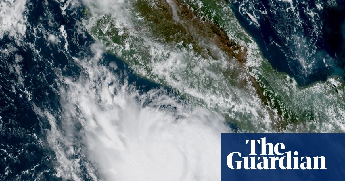
Hurricane Polo rapidly intensified from a tropical storm into a Category 5 hurricane within 24 hours, driven by powerful El Niño weather patterns in the Pacific Ocean. By Tuesday, the system was producing maximum sustained winds of 165 mph (266 km/h) as its center moved approximately 215 miles (346 km) south of Zihuatanejo in Guerrero state.
Polo had maintained winds below 74 mph (120 km/h) on Monday before undergoing sudden growth. Forecasters at the National Hurricane Center in Miami indicate that Mexico will likely avoid a direct landfall. However, officials warned that additional strengthening remains possible and cautioned that dangerous surf, rip currents, and severe inland flooding and mudslides could still impact the region.
El Niño Impact on Pacific and Atlantic Storm Seasons
The rapid escalation of Hurricane Polo aligns with exceptionally strong El Niño conditions, which feature elevated sea surface temperatures in the eastern and central equatorial Pacific. According to meteorologists, these warm waters fuel storm activity in the Pacific while simultaneously increasing wind shear in the Atlantic basin, suppressing hurricane development there.
Polo represents the 18th named storm and seventh hurricane of the 2026 Pacific season, which spans from May 15 to November 30. Conversely, the Atlantic hurricane season has yielded just six named tropical storms and zero hurricanes up to late September, marking a historic lull not observed in over a century.
0 YORUMLAR
Bu KONUYA henüz yorum yapılmamış. İlk yorumu sen yaz...